Designed specifically for the small enclosed space of the tourist information courtyard at The Heights Hotel, and constructed with stone given by Albion Stone. With a maximum height of 40 inches, it is low enough to see and lean over like a big 3D map. Ten foot long by just under three wide, it is stable and secure enough to climb or to sit on. The horizontal stone layers contrast with the surrounding ascending dark wood fencing, visually broadening the narrow space.
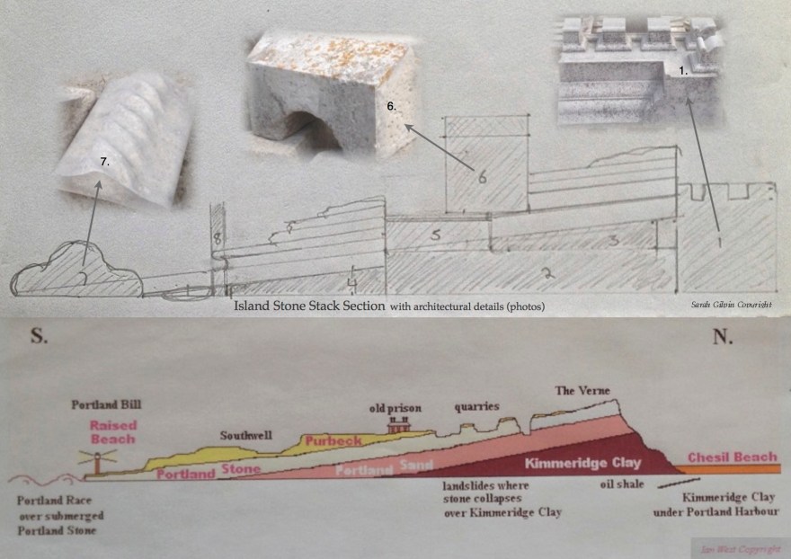
My fascination with Portland Stone resides in large part with its raw state; how it lies and fractures within the island, as well as it’s presence once brought to the surface. The impulse for the design of this installation originated in a desire to reveal these raw facets whilst reinvigorating the blocks I found languishing in the stone yard. Working in the main with sizes and shapes already in existence, I have constructed and assembled rather like a giant jigsaw puzzle, though I have had to shape a few of the pieces so as to get key features – the angled bed of the stone for example.
Inspired by Ian West’s geological map of Portland, the original working design plays with ideas of scale and form in a stylised longitudinal section through the island. Layers of cut stone placed at an angle replicate different stone beds, their overall slant on the island, and the variety of textures and patterns. Integrated natural faults and breaks replicate natural characteristics of the stone and thus also the form of the island.
Recycled architectural carving suggest landmarks on an enlarged and out of proportion scale: reminiscent of the mad hatter’s tea party. A block of crenellations, probably previously perched at the top of an important building, now represents Portland Castle at one end of the installation. A hollowed out block is now the stone railway tunnel in Tout Quarry placed towards the centre, whilst a wavy edging or capping stone at the far end suggests the sea at Portland Bill.
